
Ecosystems
By Tom Rosburg
Four main ecosystems dominate the Little Sioux River Corridor; Prairies, Savannas, Woodlands and Wetlands.
If you had floated down the Little Sioux River in 1846 when Iowa became a state, it would have carried you through a vast wilderness of many types of prairies. You would also have seen thousands of acres of sedge meadows and wet prairies, oxbow wetlands or sloughs with standing water. The sight of trees would have generated excitement, offering a place to camp with some shade, campfire wood, and maybe some fruits to calm a hungry stomach.
It certainly would have been a grand trip!
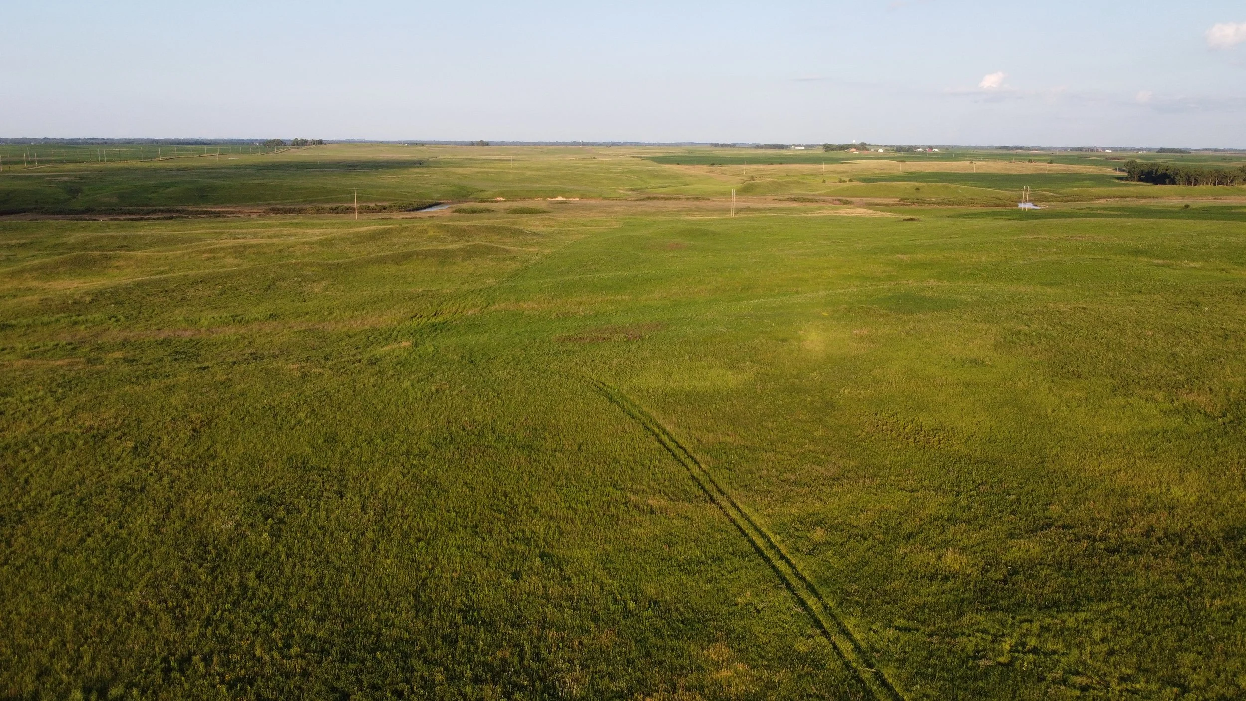
Prairies
The Little Sioux River traverses the Northwest Iowa Plain [1], the state’s highest, driest, and windiest region—averaging just 28 inches of precipitation annually. The warm, dry climate favors prairie plants over trees and promotes frequent fires, which help maintain grassland ecosystems. The orientation of the river affects how fire spreads—segments parallel to prevailing southwest winds promote prairie, while perpendicular sections act as natural firebreaks.
Iowa lies within the tallgrass prairie zone, but certain dry, sunny slopes in northwest Iowa host Great Plains species—plants typical of drier midgrass and shortgrass regions farther west[2]. These species likely migrated from South Dakota, bypassing natural barriers like the Missouri River by following dry, south-facing slopes northeast of the river valley. Prairie Sites along the Little Sioux River:
Cayler Prairie State Preserve: A rare, expansive prairie-pothole landscape where travelers can experience Iowa’s pre-settlement prairie. It hosts over 225 native plants and two federally protected species.
Freda Haffner Kettlehole State Preserve: Features Iowa’s largest glacial kettlehole, supporting over 360 plant species from wetland to dry prairie environments, including species typical of the western shortgrass prairie.
Judd Wildlife Area: Contains floodplain and upland prairie remnants along a small valley. Mesic prairie grows on lower slopes, with dry prairie higher up. Below this area, prairie remnants become sparse until near Peterson.
Professor Tom Rosburg gives a walking tour of the Kettlehole at Freda Haffner Kettlehole State Preserve as well as discuss the ecology of native plant communities.
(Video: Jordan Barry)
The Little Sioux River corridor in northwest Iowa represents a unique meeting point between the tallgrass prairie of the Midwest and the drier Great Plains to the west. Fire, climate, and geography together shape this landscape, revealing rare prairie ecosystems and harboring an exceptional mix of eastern and western plant life.
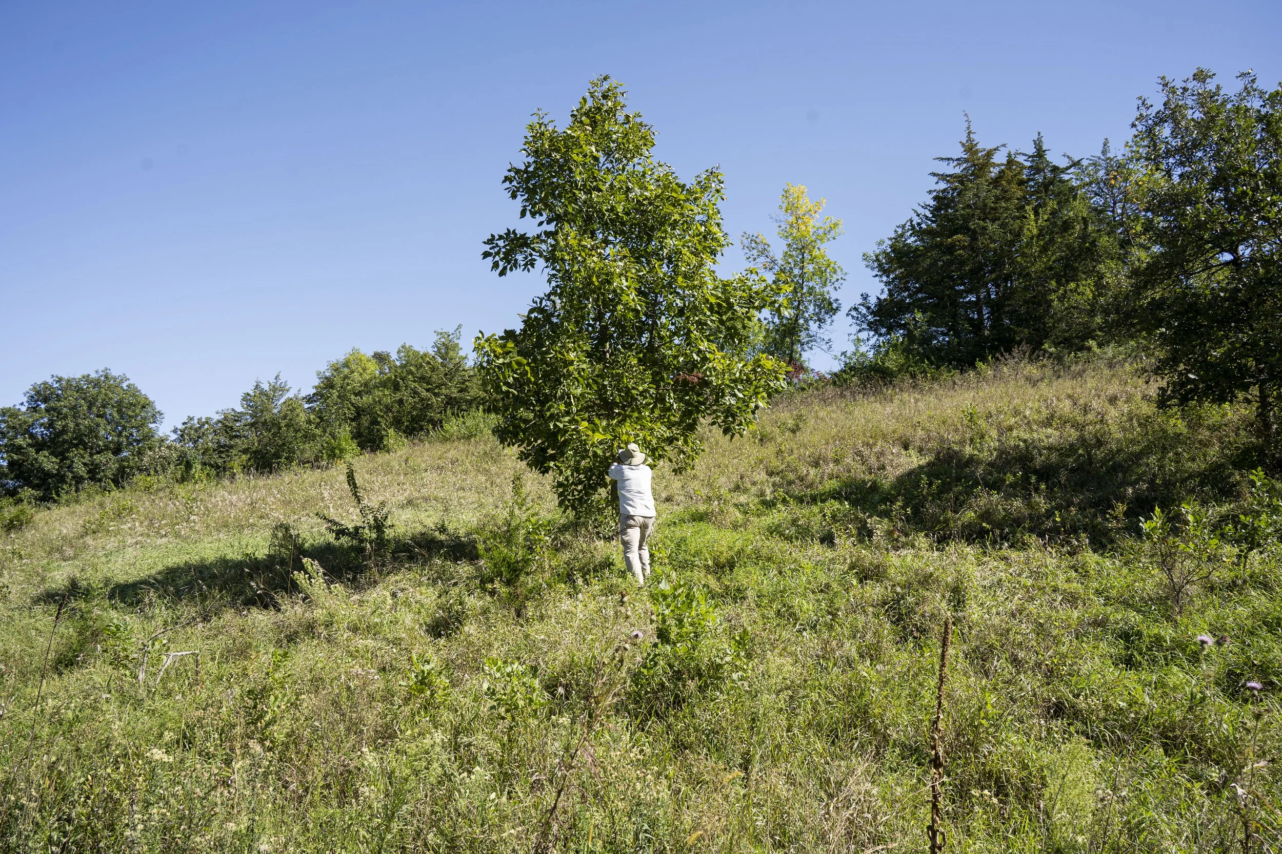
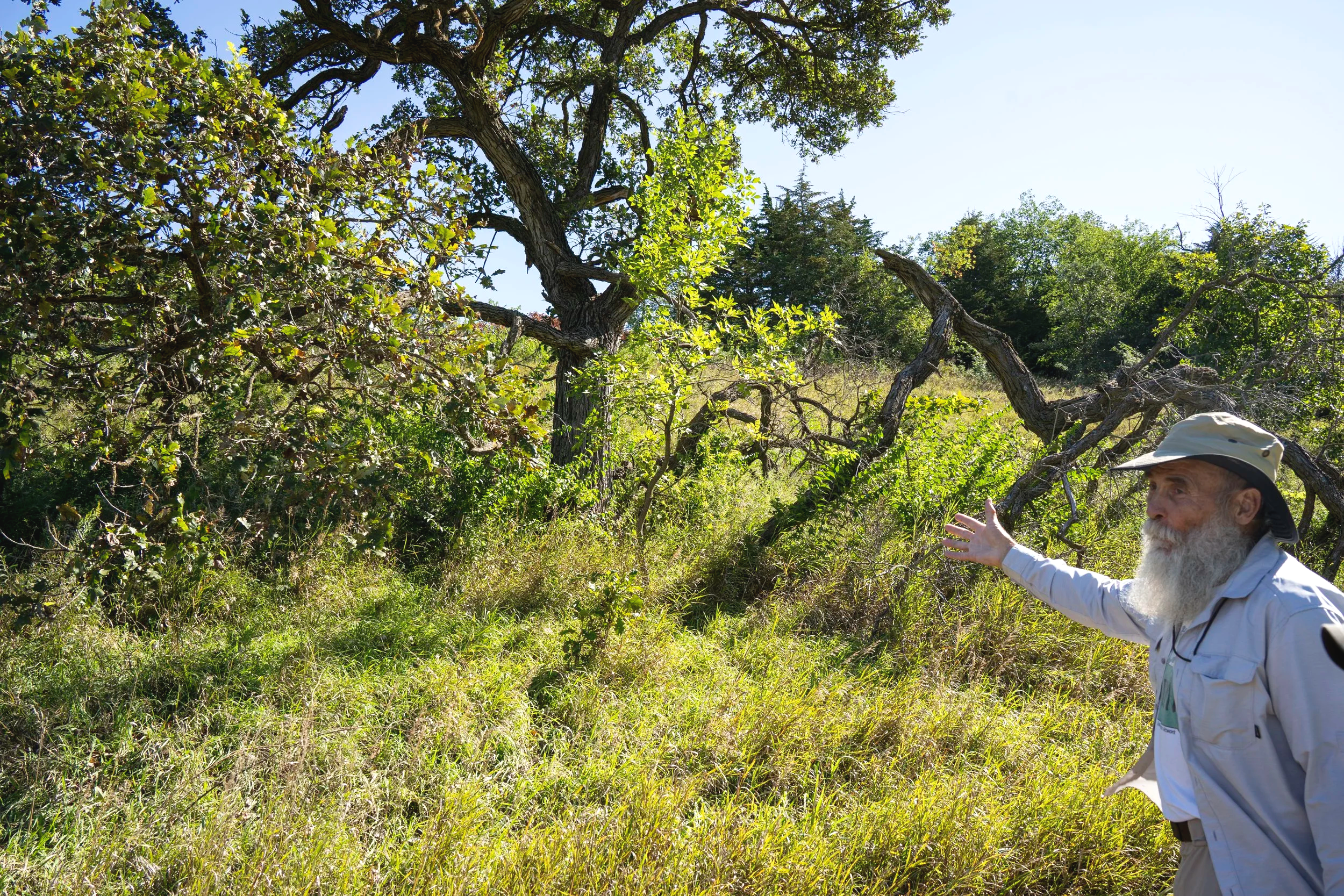
Savannas
A savanna is a transitional ecosystem between prairie and forest, typically defined as grassland with 11–35% tree canopy cover[3]. It shares many herbaceous species with prairies but includes scattered, fire-tolerant trees—often oaks—with thick bark and broad, open canopies due to minimal crowding.
Fire is crucial to maintaining savannas. Without it, tree growth increases and the landscape transitions to woodland or forest within about 50 years, shading out prairie plants and leaving only “wolf trees” (isolated, old savanna oaks) as remnants of the former ecosystem.
At Horseshoe Bend, the surrounding river likely acted as a natural firebreak, allowing trees to persist and form a savanna. The area’s soils support this, and existing bur oak wolf trees suggest a historic savanna presence. Today, its vegetation includes a mix of native forest herbs, savanna species, and non-native plants, reflecting both its ecological history and subsequent changes.
Drake University Professor Dr. Tom Rosburg pointing out a wolf tree in the Shagbark Hills near Correctionville in Woodbury County.
Savannas represent a delicate balance between prairie and forest, sustained by fire. Their decline across the Midwest illustrates how changes in fire patterns have reshaped native landscapes.
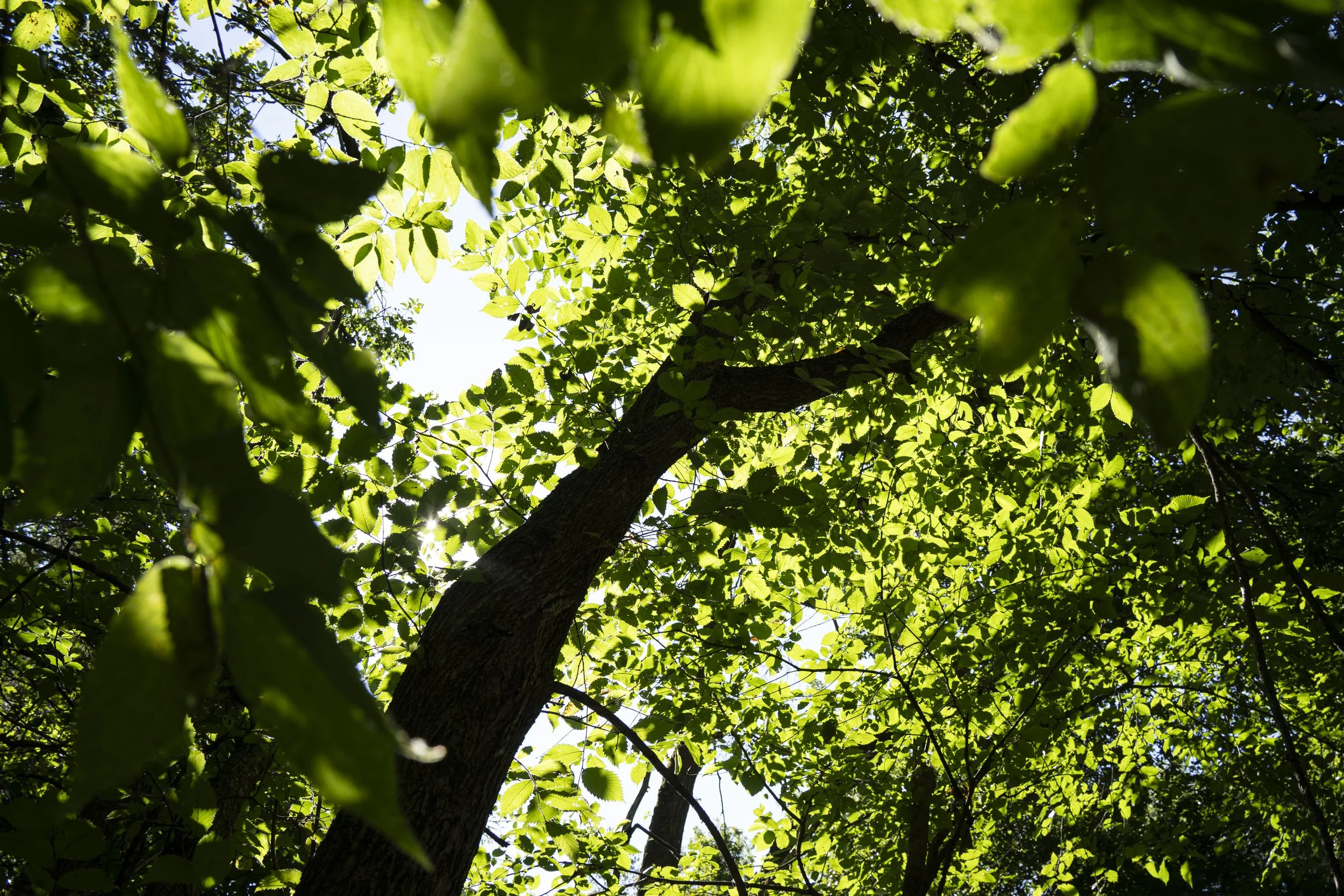
Woodlands
Woodlands represent the next stage in the prairie–forest continuum, developing where fire is less frequent. They have 36–65% tree canopy cover[4], while forests have 66–100%, where fire is rare. Open woodlands may still support some prairie plants, but denser canopies shade them out.
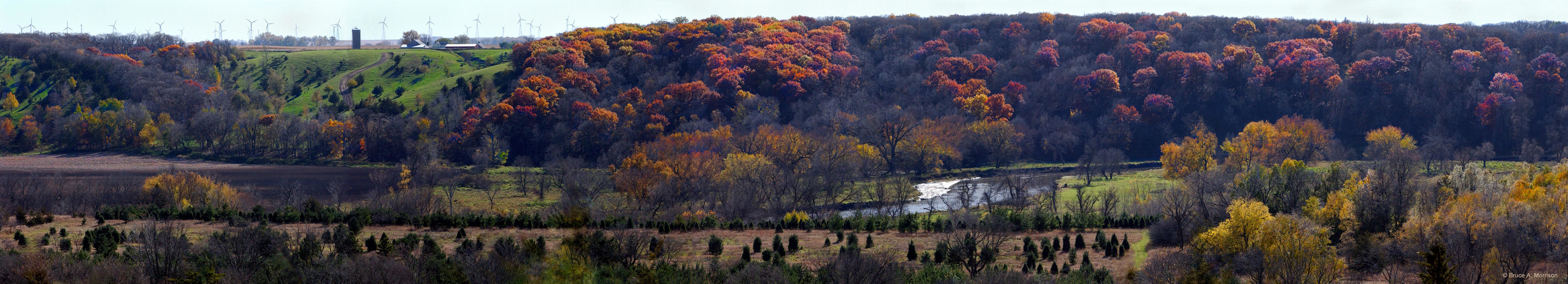
Woody vegetation is far more abundant along the Little Sioux River now than in pre-settlement times. Both floodplain forests and upland woodlands occur throughout the valley, with willows dominating streamside areas.
Horseshoe Bend: Historically the first major woodland area south of the Minnesota border, featuring silver maple, box elder, green ash, and black willow. Its understory is dominated by reed canary grass.
Oneota County Park, both upland (oak-basswood) and floodplain forests occur, with diverse herbaceous layers.
Floodplain Forests: Similar species appear throughout due to uniform soils and seed dispersal by water—commonly box elder, silver maple, green ash, black walnut, and cottonwood, with various wetland herbs.
Upland Forests: More variable due to topography and soil differences. At Little Sioux Wildlife Area and Kindlespire Complex, diverse oak-basswood and mixed hardwood forests occupy north-facing slopes.
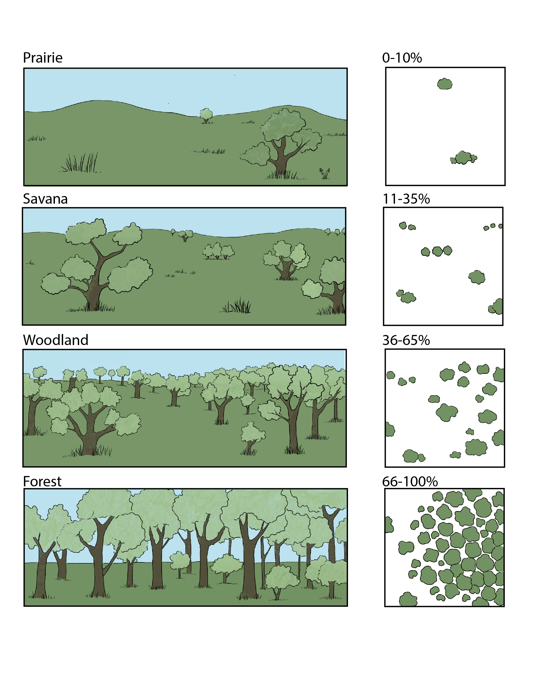
An illustration of the approximate tree cover in different ecosystems
A Woodland environment populating the bank near the Prairie Heritage Center in O’Brien County.
From southern Clay County to Smithland, floodplain forests dominate as the valley widens and the river’s course shifts to the southwest. Agricultural expansion has fragmented these forests into small, isolated patches—often surviving on the inner curves of meanders where the land is less farmable.
Wetlands
Rivers and groundwater are tightly linked—rivers can either gain or lose water depending on local geology. Floodplains, formed by river deposits, are deeply influenced by groundwater levels. Because they flood regularly, floodplains function as continuous wetlands, at least temporarily during the growing season.
Types of Wetlands in the Little Sioux River Valley:
Floodplain Forests & Willow Thickets:
These are temporarily flooded forests dependent on seasonal river overflows and shallow groundwater.Wet Meadows:
The most common non-woody wetland type, usually temporarily flooded or saturated with groundwater at or near the surface. Historically, these areas were sedge meadows or wet tallgrass prairies, but most have been converted to farmland or overtaken by invasive reed canary grass. Remnants persist at Judd Wildlife Area and elsewhere, where a few native wetland species survive.Sedge Meadows:
Among the most endangered ecosystems in the Midwest. Notable high-quality examples remain in Hawk Valley Wildlife Area between Spencer and Gillette Grove, hosting a wide variety of native wetland plants.Oxbow Sloughs:
Formed from abandoned river channels, these wetlands vary from shallow to deep-water marshes depending on age and sediment buildup. Once widespread, they contributed to a 250-mile-long wetland corridor of immense biodiversity along the Little Sioux.Fens:
Rare and unique wetlands fed by groundwater from an aquifer, typically forming peat mounds on slopes. Their cold, oxygen-poor, mineral-rich conditions support specialized plants like Kalm’s lobelia and beaked rush. Fens differ from “wet seeps,” which are seasonally wet but not aquifer-fed.A prime example is Fen Valley Wildlife Area in Clay County, featuring eight fens and numerous rare plant species.
A wetland seen within the Dugout Creek Wildlife Area in Dickinson County
The Little Sioux River valley is a rich mosaic of wetland ecosystems—from floodplain forests to rare fens—all shaped by the interplay of groundwater, flooding, and sedimentation. Despite heavy agricultural alteration, it remains one of Iowa’s most diverse and ecologically significant wetland corridors.
References & Acknowledgements
Prior, Jean 1991. Landforms of Iowa. University of Iowa Press, Iowa City.
Krajick, Kevin. 2018. The 100th Meridian, Where the Great Plains Begin, May Be Shifting. State of the Planet: News from the Columbia Climate School. Electronic document, https://news.climate.columbia.edu/2018/04/11/the-100th-meridian-where-the-great-plains-used-to-begin-now-moving-east, accessed July 3, 2025.
Packard, Stephen and Cornelia F. Mutel (editors). 2005. The Tallgrass Restoration Handbook: For Prairies, Savannas, and Woodlands. University of Chicago Press.
Packard, Stephen and Cornelia F. Mutel (editors). 2005. The Tallgrass Restoration Handbook: For Prairies, Savannas, and Woodlands. University of Chicago Press.
This section, “Ecosystems,” was originally developed and written by Dr. Tom Rosburg under the title, “Rooted in Diversity: Prairies, Savannas, and Woodlands”. Edits were made by Elizabeth C. Reetz and Chérie Haury-Artz.
This section was adapted for the web by Jordan Barry. The page heading video was captured by Benjamin Fowler, the heading photos/videos were captured by Jordan Barry. Additional imagery was captured by Tom Rosburg and Jordan Barry.
This section along with the pages; “Culture & History, Wildlife, The Dakota in Iowa & Geology” were prepared for Iowa Department of Natural Resources Water Trails Program under coordination by John Wenck.